UK weather: Hundreds of flood warnings in place as cold weather alert issued
Authorities warn falling temperatures in the coming days could mean increased risks to vulnerable people. Frosts are also set to be more widespread, with ice likely on some roads.
Saturday 6 January 2024 03:59, UK
The Midlands and the south of England have been hit by widespread flooding after heavy rain fell on saturated ground and caused rivers to swell.
As of Friday at 5pm, 250 flood warnings - meaning flooding is expected - were in place in England, as well as two in Wales.
There were also 269 flood alerts - suggesting flooding is possible, while the UK Health Security Agency (UKHSA) has warned of a coming cold snap.
Weather latest: Ice and frost warning as health alert issued
Nottinghamshire has seen 64% of its average January rainfall in just four days due to rising water on the River Trent.
People in some areas have been told to be ready to evacuate as Nottinghamshire Council said river peaks could "come close to the highest levels on record from the year 2000".
Environment Agency data shows almost every river in England is exceptionally high, with some at their highest flow on record, such as the River Itchen in Southampton.
A party boat sank in the Thames in central London, with its owners saying it was likely "because of weather conditions".
Check the weather forecast where you are
Train journeys are also likely to be affected, with South Western disrupted across its entire network on Friday and major issues on its west of England routes.
Great Western also apologised for "significant disruption" after flooding and a serious incident near Reading "involved police taking control of the line".
Sky News weather producer Joanna Robinson said the weekend looks more settled - but it will be getting colder.
A UKHSA cold weather alert begins at 9am on Saturday until noon on Friday 12 January, with lower than average temperatures forecast in many areas.
It warns of an increase in risks to vulnerable people, with "significant impacts possible" in the health and social care sector.
Frosts are also set to be more widespread and ice "likely [to] be an issue for many".
The Met Office said the cold snap would be caused by high pressure building over the UK into the next week.
The highest rain totals on Thursday were 44mm (1.57 inches) at Otterbourne in Hampshire, with 20mm to 30mm (0.78 - 1.18 inches) across many southern counties.
It came days after strong wind and rain from Storm Henk left ground saturated and more prone to flooding.
Late on Thursday, 10 fire engines and about 70 firefighters were called to a big flood in east London.
About 50 people were evacuated after a canal burst its banks in Hackney Wick, with 10 acres - roughly the size of eight football pitches - affected.
Other key developments:
• Tewkesbury in Gloucestershire has worst flooding since 2007
• Cows drown in flooded field in Derbyshire
• Police referred to watchdog after woman dies hitting fallen tree
• People stranded in their homes in Shrewsbury
Landlord in tears at 'evil' floods
Several residents of Radcliffe Residential Park, an estate of static caravans to the east of Nottingham, had to be evacuated due to high water levels.
Laurie Walker, chairman of the residents' association, said: "I've had someone knock on my door to say the water is going to rise another 25cm.
"Outside their front doors, it's like a river, I don't know if the homes have been flooded.
"To come out of the park I've had to walk through somebody else's garden to avoid the flood on the road. It's the worst it's ever been, I've been here seven years. It's a mess."
Parts of Worcestershire, the West Midlands, Bedfordshire, Gloucestershire, Leicestershire and West Sussex have also been flooded.
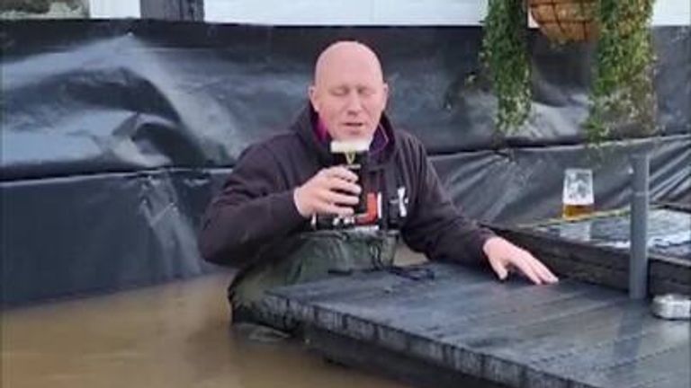
Mario Thomas, 65, landlord of The Boat Inn in Jackfield, Shropshire, said he broke down in tears after "evil" floodwaters devastated his pub.
He said the water was up to his chest.
Meanwhile, Thames Valley Police has referred itself to the police watchdog over the death of an 87-year-old woman in Oxfordshire who crashed into a tree.
The force said it received a report about the tree around 90 minutes before the collision.


